Streets named after Spanish dictatorship
January, 2019
Tech stack: D3.js, SVG, Python, Postman, Overpy, Overpass API, Tabula, Mapbox and Omniscope
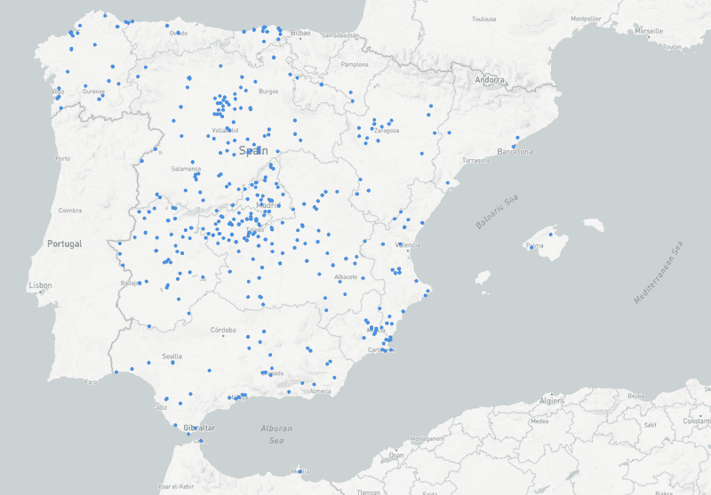
The idea behind this visualisation is to show all the streets that still keep names related to a Spanish dictatorship. The project was inspired by an
It is known in Spain that there still are streets named after the Franco dictatorship. From time to time, we see on the news that town halls vote to rename them with the opposition of right-wing parties. So I started investigating and found out that there were 1,143, at the time of writing of this other
The data format wasn't ideal and I had to use Tabula to parse it and Overpy to geolocate it. Once I had that, I could draw the streets on a map. That allows the user to explore the results from the country to the street level.
As an anecdote, while looking at the clusters of points, I found that there's a little village called Baquerín de Campos of no more than 24 inhabitants that has 5 out of the total 15 streets.